


Farr Island
Farr Island, the glamping island, is a beautiful historic and private five-acre island on Lake Temiskaming only a few kilometres from Haileybury’s marina.
Take a look at our calendar here to see availabilities for renting our individual tents.
Farr Island is one of only nine islands on Lake Temiskaming which is 110 km long. The island, owned by the Presidents’ Suites, is used mainly for glamping (high end camping) and can also be used as a day destination for our guests if the island is not reserved. What a treat to add a visit to the island during your holiday or visit to the Temiskaming region. We are located in Northern Ontario and less than half a day drive from Southern Ontario.
People can rent a glamping tent individually for a single person, a couple or a small family.
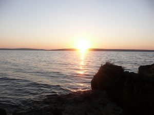
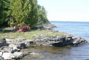
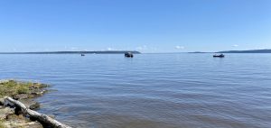
 The feeling of being on an island is unique. As you walk around the island, the scenery and the waves will change. The West side, the side where our dock and the beach is, is the closest to the main land and is also protected from the Northerly winds. Water is therefore very quiet and peaceful. If you go to the South side, you will see the lake narrowing down and it often reminds people of the Saguenay Fjords. The east side is open to the north-east winds. At times, waves could be several feet high. It is also a great place to sit to watch the sunrise. Haileybury on the north side is the only town visible from the island. Imagine being in nature overlooking beautiful Lake Temiskaming, listening to the birds and the waves! It is now possible on our Farr Island. You will find peace being surrounded by nature.
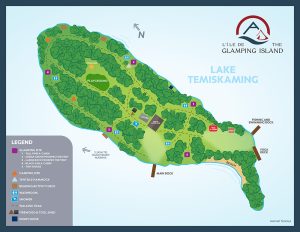 Explore the Glamping Resort
We encourage you to discover and learn about everything you will find on the island by visiting our Explore the Glamping Resort page.
You will learn more about:
- the main pavilion & kitchen
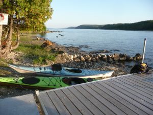
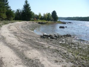
- the trail system, docks and beach
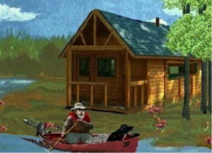
- the sleeping sites: the A-cabins, the prospector’s tents, the tiny home, the camping sites
- the sanitary facilities and shower
- the yoga, exercise & reading platforms
- the interpretation centre along with the various learning experiences
- the treasure hunt
- the sauna
- the children treehouse and park area
- the Tentsile hammock
How to Get to the Island

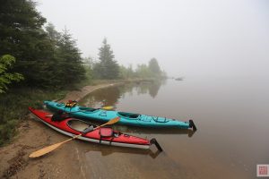
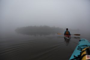
Kayaking to Farr Island. It’s not that far!
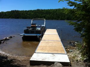
We bring most of our groups with our 28ft pontoon. We usually leave from the boat launch area located just south of city hall in Haileybury. The 2km ride will take approximately 8 minutes. Depending on wind conditions, we can bring people in groups of 10 to 15 people.
If you are planning to paddle, the island is approximately 3 km from the Villa where our dock with our kayaks and canoes are. Our kayaks and canoes are available to our guests and we also have all the necessary equipment required. For the experienced paddlers, the ride will be 35 minutes but it could take approximately an hour for a less experienced group. We would bring bagages with our pontoon. As you leave the Villa, you will be heading south towards the Marina. As soon as you get to the Marina, looking south, you will see the small island. It will be sitting right there and you can’t miss it. Water can get really rough very fast on lake Temiskaming. We strongly suggest that you verify the weather forecast prior to travelling on the lake. It is also a good practice to stay close to shore.
On your way to the island, you will pass the town hall, ‘the most expensive house in Canada (abandoned Grant Mansion), and Mill (or Farr) creek. Our main dock in on the west side of the island, the side closest to the main land.
History of the Island

Plan of Farr Island – original survey of 1904
The original aboriginal name of the island was lost over time. First Nations have been using the island for hundreds, even thousands of years. Back then, when the lake level was lower, the island was most likely a presqu’ile attached to the main land. It probably served as a resting and meeting area for First Nations people travelling on lake Temiskaming as it was located at the mouth of Mill creek, an important watercourse in the development of the region. Some people can still feel a spiritual presence when visiting or staying on the island.
At the end of the 19th century, Captain Percy, captain of the Meteor, used to get wood from the island to feed his ship’s boiler. At that time the island was known as Percy Island. If you go to the southwest corner of the island, you will see a large steel anchoring ring on top the bedrock. The anchoring device was probably used for the Meteor or to temporary anchor wood rafts. Locals also called the island ‘Gull Island’ and this is sometime still true today.
At the beginning of the century, the story was that the island was given by the Government of Ontario to C. C. Farr, the founder of Haileybury, for his work and dedication in the development of the Temiskaming region. In reality, the island was purchased by the C.C. Farr’s wife in Louise Georgina Probyn in 1905 for the amount of $30. The island was then renamed Farr Island. At the time, this island was approximately 6 acres in size. Since then, the water level has been brought up due to the Temiskaming dam complex and the size of the island is now more around 4 acres. The dam system was built to control the water level in Lake Temiskaming upstream and the flow of the Ottawa River Downstream.
The island always stayed in the Farr family until it was acquired by the Presidents’ Suites in 2014. The island was acquired from Gordon and Stuart Hayward who were C. C. Farr’s great-grand children.
Jean Paull’s Dream – A Botanical Park on the Island
 Jean Paull, a Haileybury resident, had a dream of developing a botanical park on Farr Island. Thinking that the island was crown land, he started to work on his dream in 2002. Then in 2006, he was advised that he was trespassing on private property. The island was a private property – he had been squatting the island without knowing it. He stopped and left. His dream collapsed. Jean died in 2009 at the age of 64.
This was his vision for a botanical park on the island (from his diary)
 I had plans to make a Botanical Park to place flower rock planters along the Island shoreline and along the various trails in key locations. To have picnic tables at the north and south end of the Island for people to use. Make a large tee-pee at the south end of the Island. The tee-pee represents the first Nation People during the early years of the area. People will be able to use the tee-pee or my tent-cabin to use as a camp. I also hope to install a coin- operated field glass like they have at Niagara Falls at Lookout Point where people may have a close-up view of Haileybury, New Liskeard and Notre-Dame du Nord. Have outhouses for the public to use at the north, and south end of the Island. And something for the little children, like installing a miniature dwarf village by the Enchanted Forest. Lastly, make a docking wharf for boats on the western side of the Island. This project I believe will take me five years to complete. I hope to really get started on this project next spring when I will be on my retirement pension and move to the Island so that I can dedicate my full time on it.
 The Geology of the Temiskaming Rift Valley
 The Temiskaming Rift Valley has many stories waiting to be told. From world class silver and gold mining camps, diamond bearing kimberlites, disjunct Paleozoic fossiliferous limestones, rich boreal forest landscape, the boundary of two major geological tectonic provinces, and exposed post-glacial lake bottoms, we invite you to discover a very unique geology, lying there in front of your eyes. By learning and visiting areas of Temiskaming, you will become come to appreciate the geology, this story unknown to so many. We invite you to visit the Temiskamingriftvalley.ca web site to learn more about our geology. A visit to the Fossilarium, located in Notre-Dame-du-Nord is always a hit for families. Several books have also been writing on the subject.
A major regional initiative, the Temiskaming Rift Valley Aspiring Geopark, is still in the early stages of its development. The main goal of the project is to become recognize as a fully accredited UNESCO Global Geopark.
Lake Temiskaming Fishing
Temiskaming is an Algonquin name meaning “deep waters”… Lake Temiskaming is the Ontario headwaters to the Ottawa River and acts as the provincial boundary between Ontario and Quebec. The lake also has several tributaries such as the Montreal, Kipawa, Matabitchewan, Blanche and Quinze Rivers. The lake reaches depths of 216m (709ft) and is one of the deepest in the Province. With a length of 110km’s this is one of the BIGgest lakes in the region to explore and discover. Up to 30 different species can be targeted in this BIG fishing hole including lake trout, sturgeon, walleye, smallmouth bass, northern pike, whitefish, and perch. Complete maps of lake Temiskaming are available on the web or can be purchased locally.
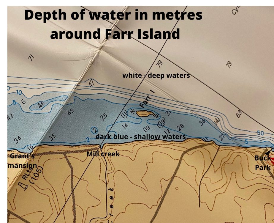
 It’s always best to have the inside scoop: The underwater rock face approximately 200ft east of the island is a very popular fishing spot for locals. Another very popular sport earlier in the season is at the mouth of Mill creek, again just a few hundred feet to the north/west of the island. Our guests have caught fish from both our docks and from fishing on the rocks at both extremities of the island. Our dock on the east side is probably better as the water is deeper. If you are bringing a fishing boat, you can use our dock. Please note that only 1 boat is allowed as we need to keep a docking space available for our pontoon. The dock can accommodate fishing boats up to 21ft in length.
Please note that we are not a fishing resort so you would need to bring your fishing gear, minnows/worms…
Please Respect the Lake
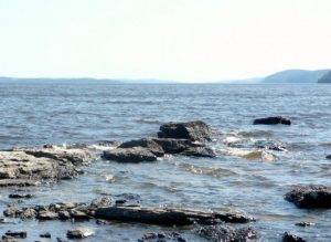
Before heading on lake Temiskaming it is important to be aware of wind conditions. On windy days, lake Temiskaming can be a very dangerous lake with waves reaching 3-5ft in height. This lake deserves the same respect given to places such as Lake Superior or Lake Nipigon. It’s definitely not something to be flippant with, especially the lower half. This section seems less menacing on the map because it’s a narrower stretch. But don’t be fooled, high rock walls funnel winds from any direction and the waves build and build over elongated stretches of open water. Lake Temiskaming it a miniature version of lakes Superior and Nipigon and has a tendency to sculpture waves closer together and with steeper sides.
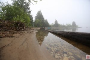
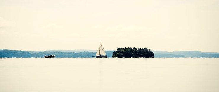
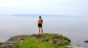
A Few Photos of Farr Island